


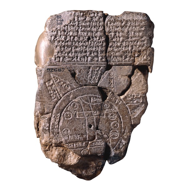
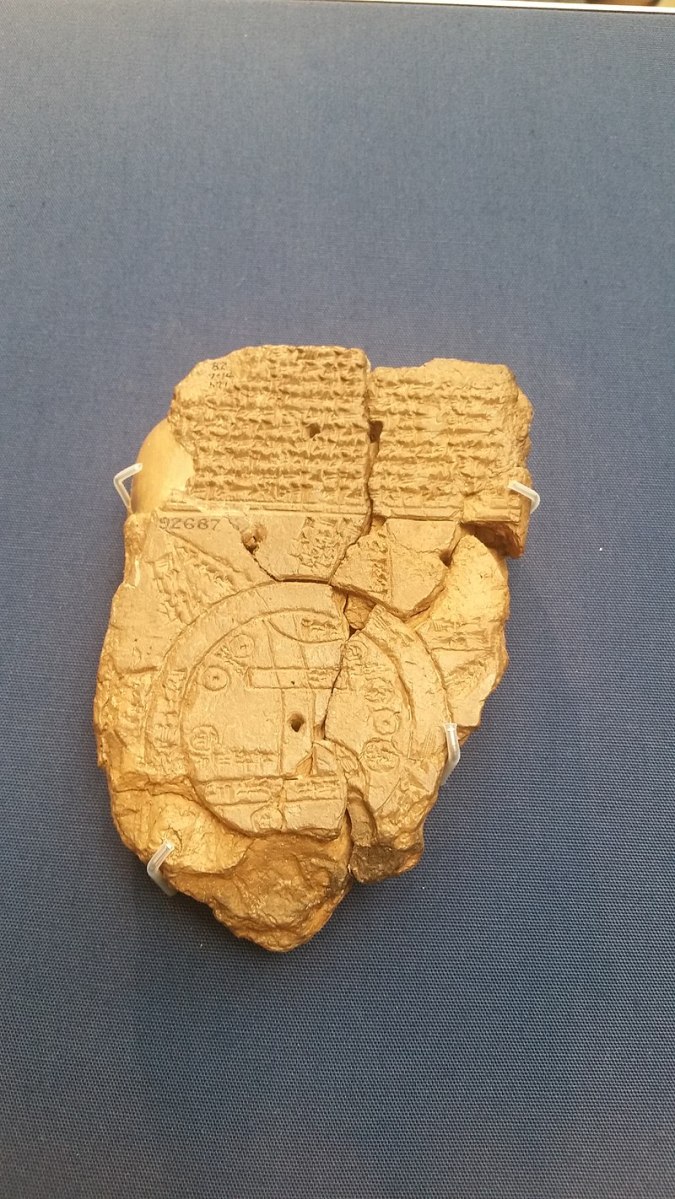
The ancient world has always fascinated us, providing tantalizing glimpses into the beliefs, perspectives, and knowledge of civilizations that shaped human history. One of the most intriguing artifacts from this era is a cuneiform tablet that not only contains a unique map of the Mesopotamian world but also reveals the Babylonian worldview through its accompanying text. This tablet, dated around 700-500 BCE and likely originating from Sippar in southern Iraq, offers a fascinating insight into the mythological and geographic understanding of an ancient culture.
The Mesopotamian World Map
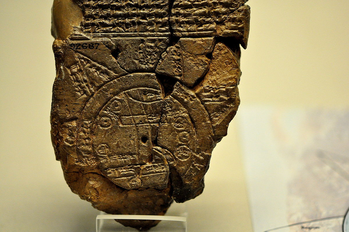
At the core of this artifact is a circular map depicting the Mesopotamian world as envisioned by the Babylonians. The map centers on Babylon, represented as a rectangle in the upper half of the circle, with other notable regions such as Assyria and Elam clearly labeled. Encircling this central area is a waterway known as the “Salt-Sea,” which is surrounded by what were originally eight distinct regions, each represented by a triangular shape. These triangles are labeled as either “Region” or “Island,” and the accompanying text provides intriguing details about the mythological creatures and legendary heroes believed to inhabit these mysterious realms. While the text is not entirely complete, it offers a captivating glimpse into the Babylonian perception of the world beyond their borders.
Approaching the Mythological Landscape
The triangular shape of the regions surrounding the central Mesopotamian world was a deliberate choice, reflecting the Babylonians’ view of these areas as appearing in this manner when approached from the sea. This innovative cartographic technique highlights the Babylonians’ attempts to reconcile the physical landscape with their mythological beliefs.
Interpreting the Mesopotamian World Map
Though sometimes interpreted as an ancient attempt at geography, scholars now recognize that the map’s true purpose was to convey the Babylonian mythological worldview. The placement of the regions and the inclusion of fantastical creatures and legendary figures indicate that this map was not intended as a literal representation of the physical world but rather as a symbolic portrayal of the Babylonians’ cosmological beliefs.
The Significance of the Mesopotamian World Map
This artifact provides a unique and invaluable glimpse into the worldview of an ancient civilization. By combining a visually striking map with a rich textual narrative, the Mesopotamian world map links us to the beliefs, perspectives, and cultural imagination of the Babylonians. It invites us to step outside our modern understanding and engage with the mythological and geographical conceptions that shaped the lives and experiences of those who lived centuries ago.
Conclusion
The Mesopotamian world map exemplifies the enduring power of ancient artifacts to captivate and enlighten us. Through its intricate design and compelling textual accompaniment, this cuneiform tablet transports us to a bygone era, revealing the Babylonians’ unique perspectives on their world. As we continue to study and interpret this artifact, we gain invaluable insights into the rich tapestry of human civilization and the enduring curiosity that has driven us to explore and understand the world’s mysteries since the dawn of time.
